Expedition Trekking through the Last Great Wilderness Area in Europe: Sarek National Park
Highlights
- One of Europe’s last true wilderness areas, Sarek National Park is situated north of the Arctic Circle in Swedish Lapland.
- Established in 1909, Sarek was one of Sweden’s first designated National Parks, and due to its remote and largely trail-less nature, it has remained the province of experienced adventurers ever since.
- It is one of those places where everything seems to be great: valleys, glaciers, mountains, rivers and animals (bears, wolves, wolverines, elk and reindeer)
Introduction:
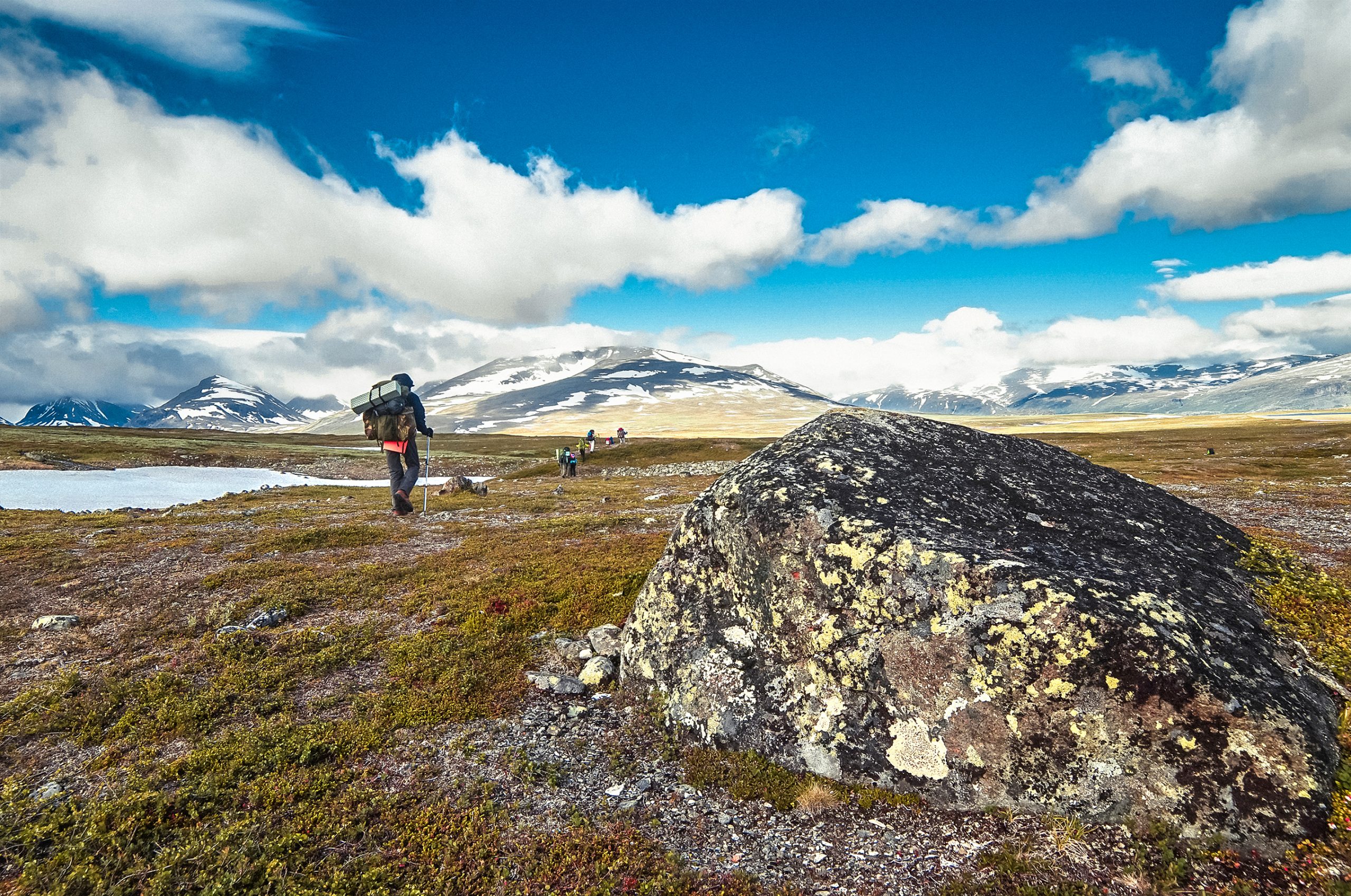
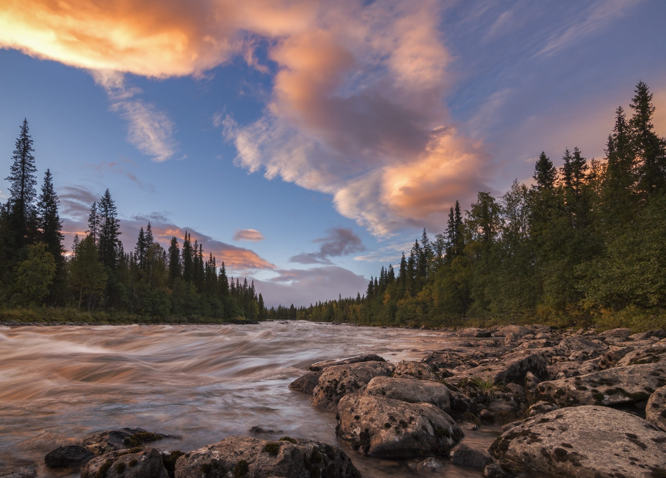
One of Europe’s last true wilderness areas, Sarek National Park is situated north of the Arctic Circle in Swedish Lapland, in Norrbotten county. It’s one of those places where everything seems to be big – valleys, glaciers, mountains, rivers and animals (e.g. bears, moose and lots of reindeer). Established in 1909, Sarek was one of Sweden’s first designated National Parks, and due to its remote and largely trail-less nature, it has remained the province of experienced hikers, climbers and cross country skiers ever since. It has an area of 1.909 km2 and it adjoins two other national parks—Stora Sjöfallet on the north and Padjelanta on the west. ,The shape of Sarek National Park is roughly circular with an average diameter of about 50 km.
Sarek is a popular area for hikers and mountaineers. Beginners in these disciplines are advised to accompany a guide since there are no marked trails or accommodations and only two bridges aside from those in the vicinity of its borders. The area is among those that receives the heaviest rainfall in Sweden, making hiking dependent on weather conditions. It is also intersected by turbulent streams that are hazardous to cross without proper training.
Geography:
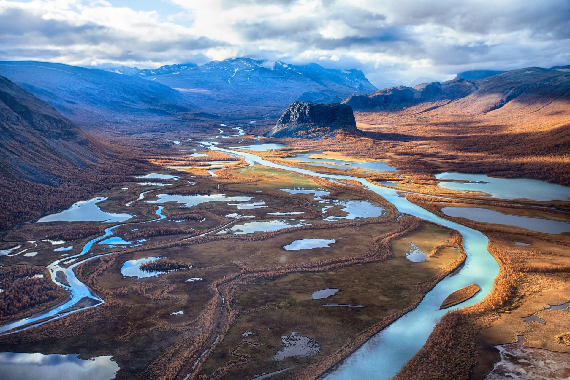
The almost inaccessible region, characterized by high peaks, deep valleys, wide plateaus, and glaciers, is drained by Rapa River, which empties into Lake Laitaure. The peaks of several mountains rise above 2.000 metres. The highest, Mount Sarek 2,089 metres, is the second highest in Sweden, after Mount Kebne.
The most noted features of the national park are six of Sweden’s thirteen peaks over 2,000 m located within the park’s boundaries. Among these is the second highest mountain in Sweden, Sarektjåkkå, (Mount Sarek) with 2.089 metres is the second highest in Sweden, after Mount Kebne.
The massif Áhkká is located just outside the park in the North West region. The park has about 200 peaks over 1,800 m ,82 of which have names. Due to the long trek, the mountains in the district are seldom climbed. There are approximately 100 glaciers in Sarek National Park.
The lowest altitude in the park is found in the southwest, near Lake Rittakjaure, at 477 m.
The park is made up of three types of landscape, sometimes difficult to differentiate between: large valleys, massive mountains, and high plateaux. The largest valley of the park, which is also the most noted, is the Rapa Valley. This valley occupies 40 km2 of the park, including several branches, the most important of which are the Sarvesvagge, which climbs as far as Padjelanta, the Kuopervagge — with an area of nearly 20 km2 — and the Ruotesvagge, surrounded by numerous glaciers, including those of Mount Sarektjåkkå.

The delta of the Rapa River is considered one of Europe’s most noted views and the summit of mount Skierfe offers an overlook of that ice-covered, glacial, trough valley.
Glaciers:
The park has over 100 glaciers, making it one of the most glacier-rich areas in Sweden. The glaciers are relatively small, the largest being Pårtejekna in Pårte at 11 km2 However, some of the others are relatively large for Sweden, since the largest Swedish glacier, Stuorrajekna in Sulitelma (south of Padjelanta), measures 13 km2
The evolution of the glaciers, particularly that of the Mikka (8 km2) have been studied since the end of the 19th century. The other glaciers in the park have an evolution similar to that of the Mikka: in 1883 to 1895 they were mostly receding, then advanced a little in 1900 to 1916, after which they started to recede again. Later they stabilised or grew, which was interpreted as being caused by the increase in winter precipitation related to global warming. The receding of the glaciers has resumed at a particularly rapid pace during the first years of the 21st century.
Wildlife:
According to its WWF classification, Sarek National Park is situated in the Scandinavian Montane Birch forest and grasslands ecoregion, with a minor section in the Scandinavian and Russian taiga. With regards to the flora and fauna, Sarek does not have a wide variety of species.This is mainly explained by the fact that most of the park, except the south and south-east part,is above the growth-limit of conifers, which is at an altitude of about 500 m in this region. Adding to this, unlike most of the region, Sarek National Park has few vast lakes or swamps. A total of approximately 380 species of vascular plants have been found in the park, as well as 182 species of vertebrates, 24 mammals, 142 birds, 2 reptiles, 2 amphibians and 12 fish. Many of these species are on the Swedish red list of endangered species, notably the large carnivores.
The vegetation follows a fairly strict altitudinal zonation, as a result of the climate, and implying a similar zonation of fauna, although this is often less strict
Montane zone
The montane zones are relatively rare in the park, as its upper limit is about 500 m below most altitudes in these northern latitudes. The flora of this zone is constituted by old-growth forests of conifers, with mainly Scots pines and including Norway spruces. The pines can become very tall, particularly those around Lake Rittak, in the south part of the park. The undergrowth is mostly covered with mosses and lichens, in particular reindeer lichen, and also with Vaccinium myrtillus, Empetrum nigrum and cowberry.
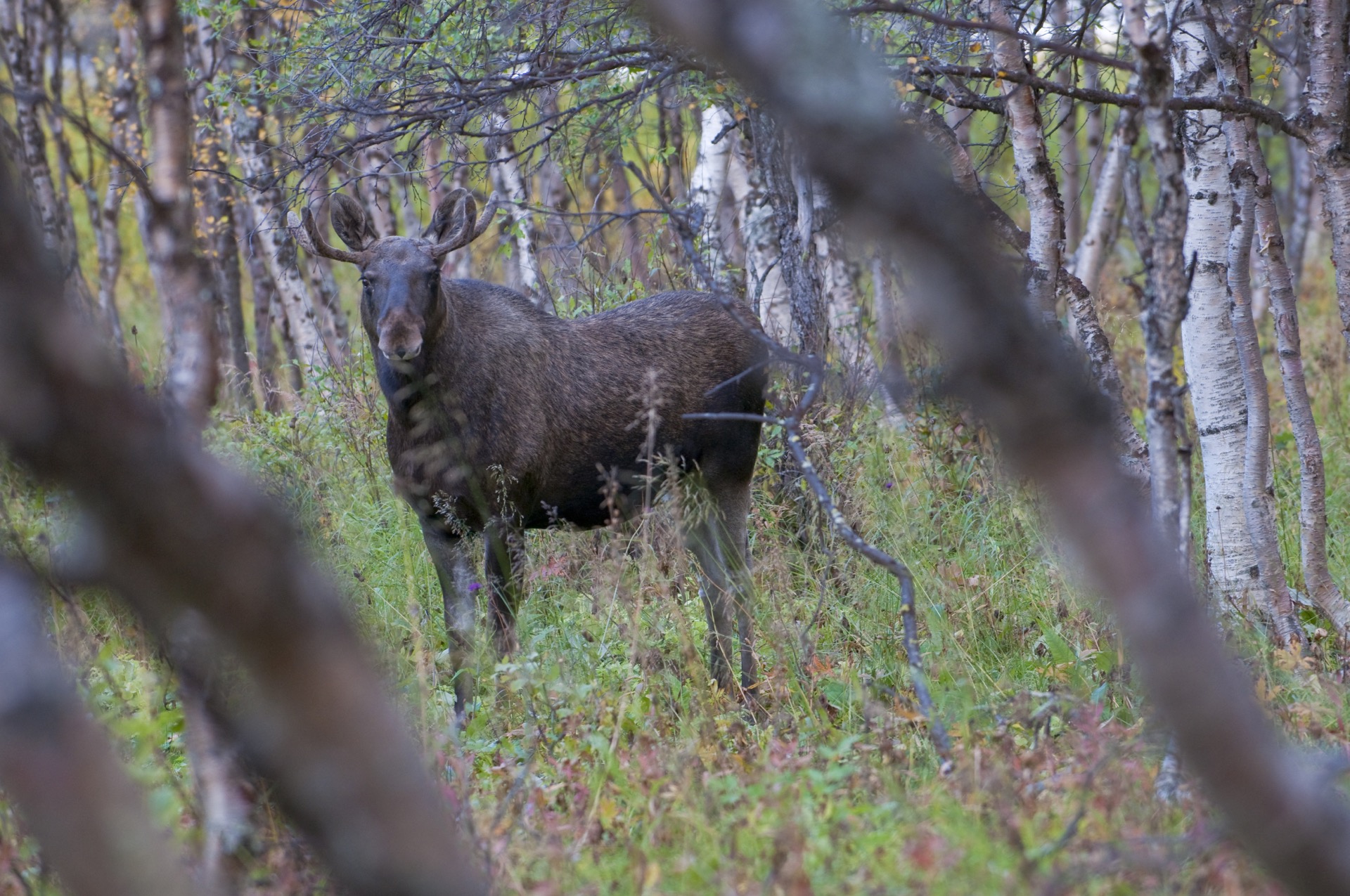
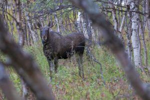
The Sarek forests are a preferred habitat for numerous species of animals. Among the large carnivores, the brown bear is particularly frequent in the park and in the neighbouring Stora Sjöfallet. The bear fairly often also ventures into the subalpine region. The Eurasian lynx, classed as an endangered species in Sweden, is also found around the lakes of Rittak and Laitaure, and is also found in the subalpine forests of Rapa Valley. The red fox is relatively frequent, and is gradually extending its territory into the higher zones, where it competes with the arctic fox. Some small mammals that are frequent in the park are the European pine marten, the least weasel and the stoat. The ermine is also found in the higher regions. The herbivores include a very large number of moose as the forests and humid zones provide them with lots of food.They often grow to an impressive size in the park, with enormous antlers.
The birds in Sarek include a number of owls, such as the Ural owl, and woodpeckers, particularly the Eurasian three-toed woodpecker. The grey-headed chickadee is also very common, as are the fieldfare, the song thrush and the redwing. Reptiles and amphibians, such as the viviparous lizard, the common frog and the common European viper, are mostly found in the forests. The vipers of the Rittak region frequently reach remarkable sizes.
In the verdant birch forests you will find willow warblers, bramblings, blue-headed wagtails, bluethroats and pied flycatchers. Teal, tufted ducks and other small waterfowl swim in the small lakes, and higher up on the alpine heaths Lapland buntings, golden plovers, dotterels and grouse can be heard. In Sarek there also are many birds of prey such as golden eagles, rough-legged buzzards and merlins.
Subalpine Zone
The subalpine zone mostly consists of old-growth birch forests. These forests are exceptional in terms of density and richness, making it possible for significant quantities of sediment material to be carried from the mountainside by the runoff and deposited in the watercourses.This kind of transfer is particularly noted in the Rapa Valley.In general, the transition between the conifer forests and the ones consisting of birch is more or less gradual, with the number of birches present in the coniferous forests increasing along with the altitude until the conifers have completely disappeared. The size of the trees also diminishes with increasing altitude. The upper altitude limit for the forests — which is also the tree line varies greatly throughout the park, from 600 m in the Tjoulta valley to over 800 m in the Rapa Valley.
The birch forests also contain other species of trees. The number of rowan, grey alder, trembling poplar and hackberry is relatively high. The alpine blue-sow-thistle is very widespread in this zone and is the food the bears prefer. Garden angelica also grows in the forests, reaching a height of 2 to 3 m. Many other plants in this zone can also attain exceptional size.
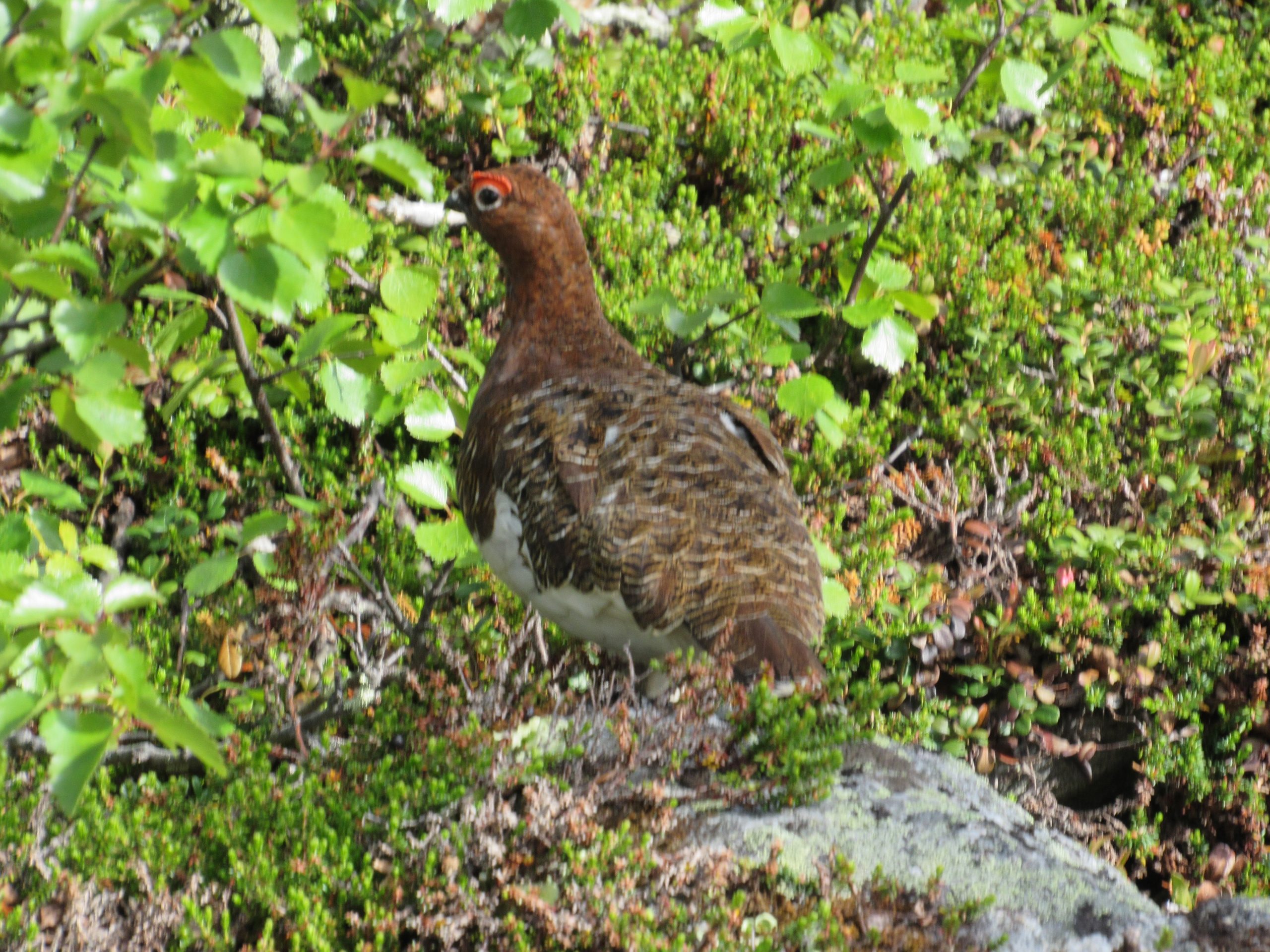
The division between the birch and coniferous forests is relatively blurred, with many of the animal species listed above also present in the subalpine zone. Some small mammals are found more frequently here than in the coniferous forests, particularly several rodents such as the common shrew and the field vole. This is also the reindeers‘ habitat. The Sami people living within the borders of the park, have domesticated the reindeer that stay in this zone during spring and move up to the alpine zone in summer. Brown bears are common in the valleys of Tjoulta and Rapadalen. However, it is the quantity and variety of birds is that enriches this zone.The willow warbler, the common redpoll, the brambling, the yellow wagtail, the northern wheatear and the bluethroat are characteristic of the birch forests. The willow ptarmigan is also more common in this area. The raptors present in the zone are the merlin and the rough-legged buzzard, which often nests on the cliffs. The gyrfalcon and the golden eagle usually prefer lower altitudes, but are nevertheless also found in the park.
Alpine zone
The alpine zone is divided into several narrower zones. The first subzone is mostly characterized by heathland, with many alder shrubs, mosses and lichens, and frequently dense mats of crowberries. In the chalky soils of this subzone, the vegetation is very rich and forms prairies with mountain avens as the most characteristic species. purple saxifrage, velvetbells, alpine pussytoes and alpine veronica are also present. With increasing altitude, the dwarf willow and lichens become more prominent, forming a second zone. Gradually the plants become more scarce, and above 1,500 m there are only 18 types of plants present.
There are three rare mammals who live in this zone. The wolverine inhabits a vast territory, roaming as far as the coniferous forests in winter, but the alpine zone is their main territory. They mostly eat carrion, but they do also hunt living animals such as small rodents, birds and insects.The wolverine is labelled as an endangered species in Sweden with an estimate of 360 individuals in the country in 2000.The Arctic fox is a critically endangered species in Sweden, with only 50 individuals in the whole country.They dig extensive networks of tunnels in areas above the tree-line, with several families inhabiting the same sett.The park is one of the last sanctuaries for the gray wolf, a species also critically endangered in Sweden. In 1974–1975, the park was home to the only remaining wild wolf living in Sweden. Although the wolf population is now growing, they have not yet achieved a stable number in the park.
In addition to these three mammals, Norway lemmings are also found in the park. The number of lemmings varies extremely, with massive spikes in the population during some years, immediately followed by a very rapid decline. This phenomenon is not completely understood; it appears that favourable weather, and therefore a surplus of food, results in sudden population growths, but the reason for the decline is less obvious, although it is certain that contagious diseases play some role. These cycles are also reflected in the populations of animals who prey on the lemmings.
Many birds living at this altitude are associated with the humid zones. However, the alpine zone has its own characteristic species, such as the rock ptarmigan, the snowy owl, the horned lark, the meadow pipit, the snow bunting and the Lapland longspur.
Humid zones
Although the park does not have the vast marshes and lakes characteristic of the rest of the region, water is nevertheless present everywhere. The humid zones are rich with a great diversity of flora and fauna. The stratification of vegetation is just as valid in the humid zones. In the montane region, the humid soils are covered with flowers such as the northern Labrador tea, cottonsedge, the Goldilocks buttercup, St Olaf’s candlestick, common selfheal and common marsh-bedstraw. In the subalpine zone, the humid prairies mainly have mats of Globe-flower, kingcup and twoflower violet. In the alpine region there are many subalpine plants as well as the Pedicularis sceptrum-carolinum, and the vegetation decreases as the altitude increases.
The humid zones of the park are well known for their rich diversity of birds. The common crane, the wood sandpiper and the short-eared owl are found at the lower altitudes, while the Eurasian teal, the Eurasian wigeon, the greater scaup, the red-breasted merganser, the sedge warbler and the common reed bunting are common in the Laitaure delta and around Pårekjaure Lake.
At higher altitudes, Vardojaure Lake is rich with birds, mostly ducks and also the European golden plover, characteristic of the alpine zone and sometimes found in the humid zones. Låotakjaure Lake, on the border of Padjelanta, is interesting from an ornithological point of view. Other rare species are also present, such as the lesser white-fronted goose, the great snipe, the red-throated pipit, the long-tailed duck and the bar-tailed godwit. The Luottolako Plateau is also considered to be interesting, with the most significant concentration of purple sandpipers in Sweden.
Arctic chars, trouts and common minnows are found in the park’s lakes, rivers and streams.
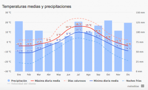
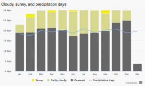
Climate:
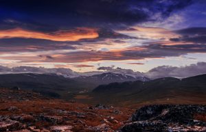
From June to September, Sarek is known as one of the stormiest areas in Sweden. The unpredictable weather combined with the lack of shelters and trailless nature of the terrain, means that it is not a place you want to be without sufficient warm layers and good rain gear.
As one of Sweden’s most famous proverbs says: “Det finns inget dåligt väder, bara dåliga kläder” (in English – “there is no bad weather, there are only bad clothes”)
The Sami People
The region’s first inhabitants arrived with the retreat of the inland seas 8,000 years ago. They were nomads who lived in Northern Scandinavia, and probably ancestors of the Samis. Initially they were hunter-gatherers, living off reindeer. For those people, the mountains often had religious connotations, and several were Sieidi (places of worship). Offerings, such as antlers from reindeer, were often made in those places. One of the most significant Sieidi was situated at the foot of Mount Skierfe (1,179 m), at the entrance to the Rapa Valley. Samis from the entire region gathered in this place for ceremonies. Mount Apär itself, was believed to be the home of demons and legend tells of an illegitimate child’s ghost inside it.
Despite their hunter-gatherer way of life, the Samis kept some domesticated reindeer. They were milked and used for transport as well as other things. Towards the end of the 17th century, the number of domesticated reindeer increased, and the Samis began to harmonize their travelling with the reindeer’s search for pasture. Eventually, hunting the reindeer gave way to farming them. The Samis in the mountains gradually developed a system of transhumance (movement between fixed summer and winter pastures). They spent the winters on the park’s plains and moved up into the mountains in summer, mainly to Padjelanta. Sarek was mostly used as a corridor for travels, although certain prairies (Skarja and Peilavalta in particular) were used for pasture. For shelter during their long journeys, which could last for several weeks, the inhabitants built huts (kåta) at selected places in the park. Little by little, they left the reindeer to graze as they pleased, and stopped moving with the herds in the old way.
In 1977, the Sami people were recognised by Sweden as an indigenous people and a minority group, which implies that the people and their way of life are protected by law. This grants the Sami the right to farm reindeer in the park. The park is situated on territory belonging to the Sami communities of Sirkas, Jåhkågaskka and Tuorpons, the Sami who are members of these communities are also allowed to pasture their reindeer in the park. In carrying out these activities, the Sami have the right to use motorised vehicles such as snowmobiles or helicopters
Park Rules:
The park rules are relatively strict, to preserve the park in its near-pristine condition. Fishing, hunting, picking flowers and any other activity that could damage the wildlife are all forbidden, except for picking berries and edible mushrooms. Similarly, no motorised vehicles are allowed in the park
Our Trip:
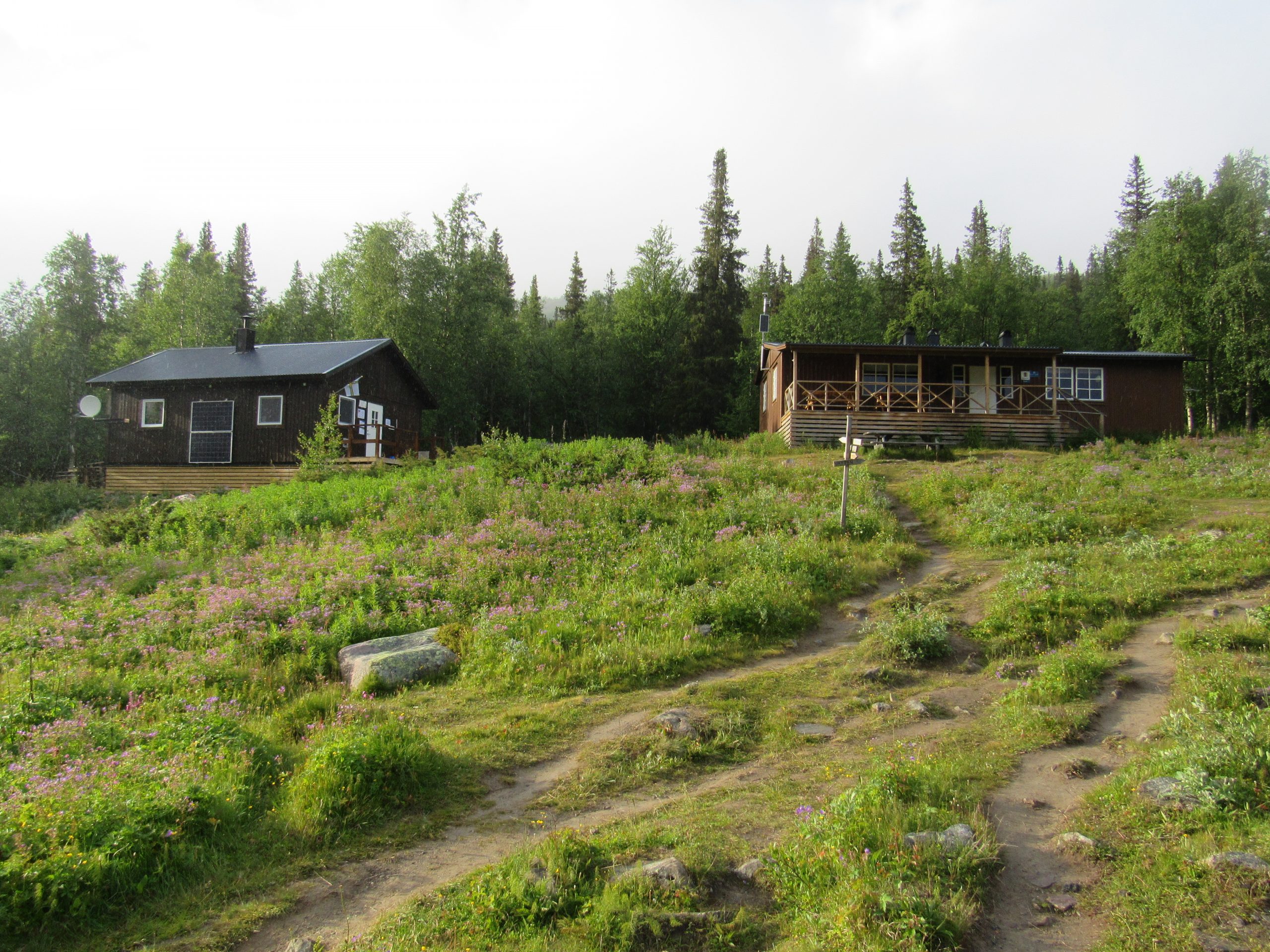
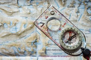
This trip is made in a total of 12 days and of these, 8 days of trekking, from Ritsem to Saltoluokta through the Sarek National Park. This 115 km traverse crosses a remote area and gravel and rugged terrain. In addition to the sporting element, the objectives are also to enjoy the experience of nature and adventure. We also hope to see some wild animals. There are no villages on the road. We will find 4 STF cabins on our route. Only our initial and final point are permanently inhabited (Ritsem and Saltoluokta).
In this desolate area we will make a 7-day hike (+1 reservation), on which we will depend completely on ourselves. Only in Aktse can we find a small shop. We will sleep in tents most of the time and each member must bring their own equipment, fuel and food. We will sleep in cabins the first night and the last night. Akkastugan and Saltoluokta. We will take the ferry from Ritsem to Akkastugan and from Saltoluakta to the bus station.
We make the trip in a north – south direction, the advantage is that we have the sun on the face during the day and the cold north wind on the back. The last 2 days we have to go north on the famous Kungsleden. Saltoluokta is a good place to end the walk.
- Stockholm-Gallivare night train
- Bus ticket Gallivare-Ritsem
- Bus ticket Kebnats-Gallivare
- Boats tickets 4x
- Amaroq Explorers guide
- STF-cabins (1 night at Ahkkastugan)
- STF-fjallstations (1 night at Saltoluokta)
- Tents and stoves during the crossing in Sarek
- Safety equipment
- Activities according to the program
- Flights
- Airport taxes, excess baggage, overweight
- Travel insurance
- All meals and drinks
- Food and drinks at STF-fjallstations
- STF-membership
- Personal gear, clothing, sleeping bag, ask if there are any questions
- Any service not specified in included
-
Flight to Stockholm. We will be arriving and gathering at Stockholm in the early
afternoon. At the end of the afternoon we will take the night train to Gällivare. We will sleep in
the night train.
-
(1,5 km) Early in the morning we will arrive in Gällivare by train. In Gällivare we will take the bus to Ritsem where we will arrive early in the afternoon. In Ritsem we will catch the ferry across the lake Áhkkájaure). With good weather we will have a nice view at the
impressive glaciers of the north face of the Áhkká (2015m).We will spend the night in Áhkkástugan (STF-cabin).
-
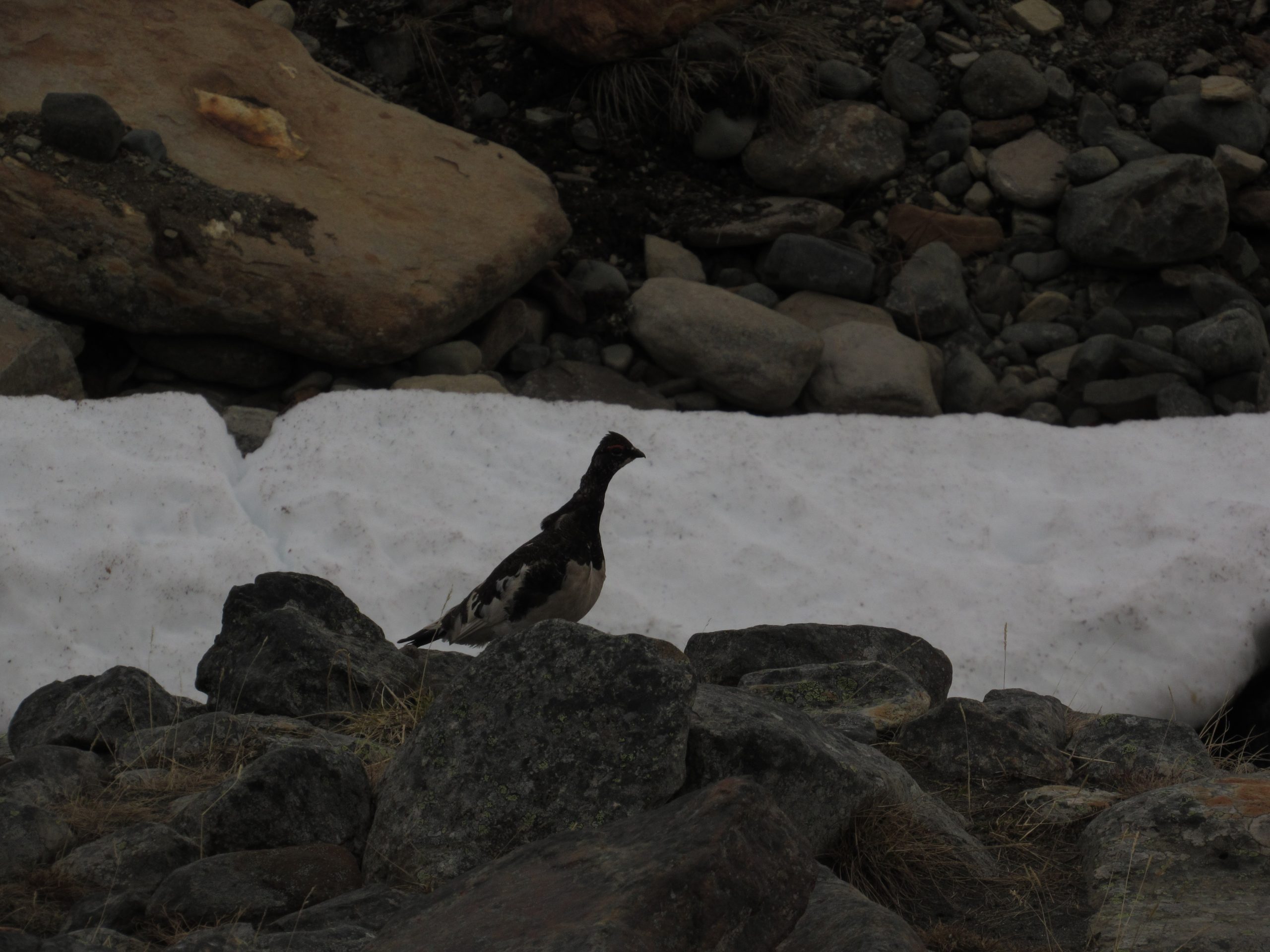
(16 km) We are leaving the Ákkástugan and will follow the Padjelantaleden, which goes up and down trough the forest. Perhaps we will spot some snow grouses in the bushes.
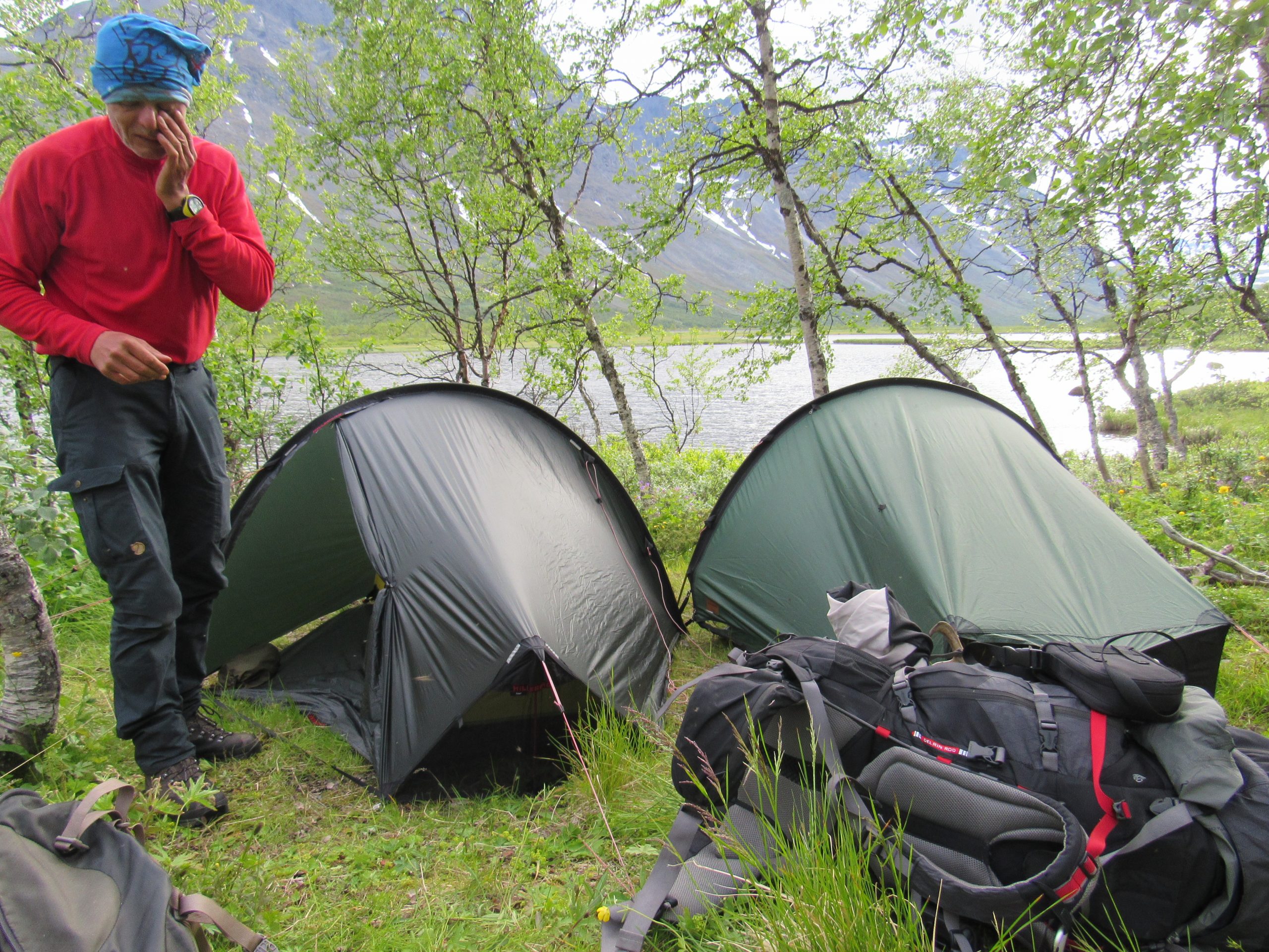
At last we will arrive at the STF-cabin Kiskurisstugan. We officially enter Sarek National Park just after leaving this cabin. Slowly we will ascent into the valley to make camp, where we will sleep in our tents for the first time this trekking.
-
(17,5 km) After waking up in the great outdoors, we will strike camp and move further on. When the weather is clear we can see the south face of the Áhkká on our left hand.
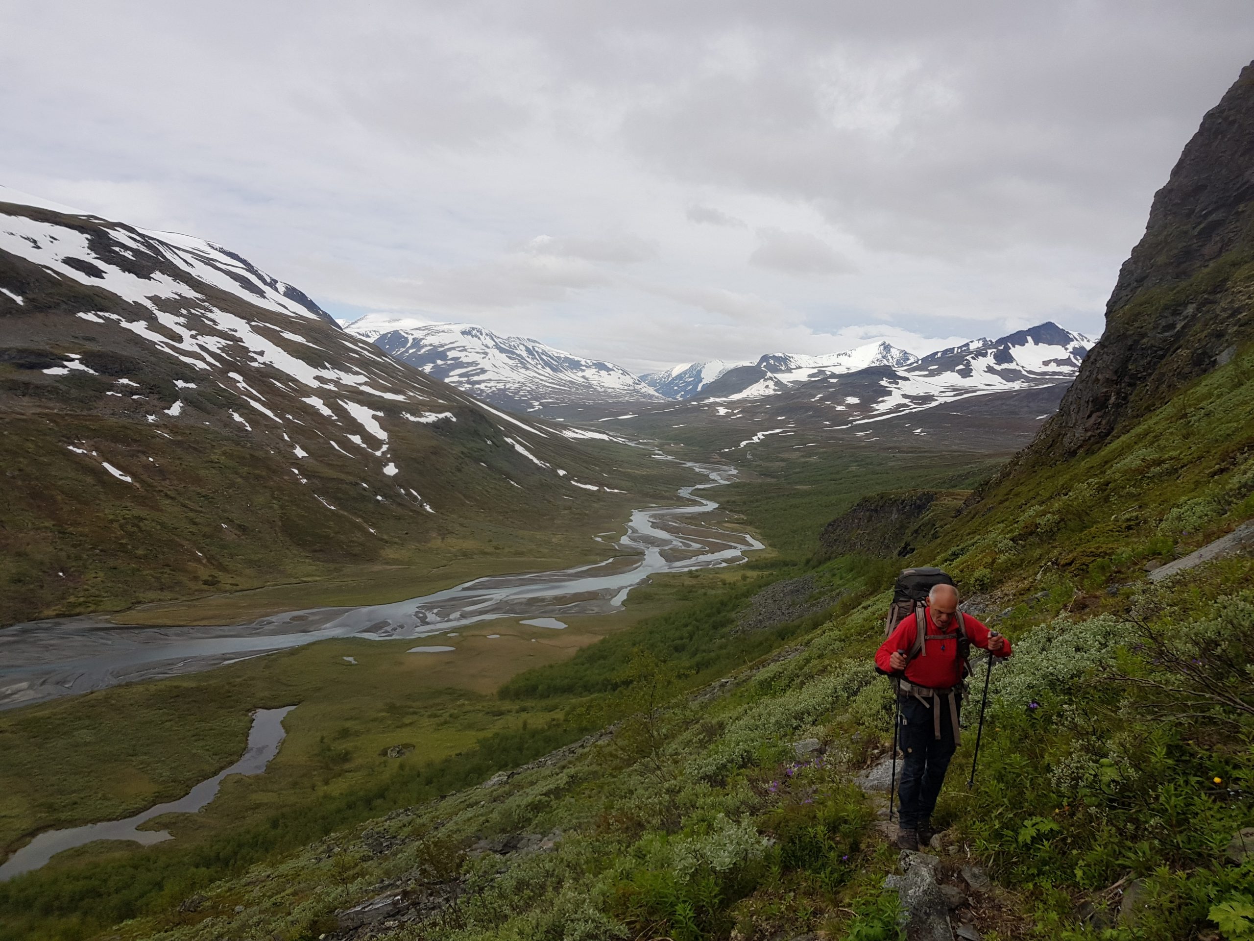
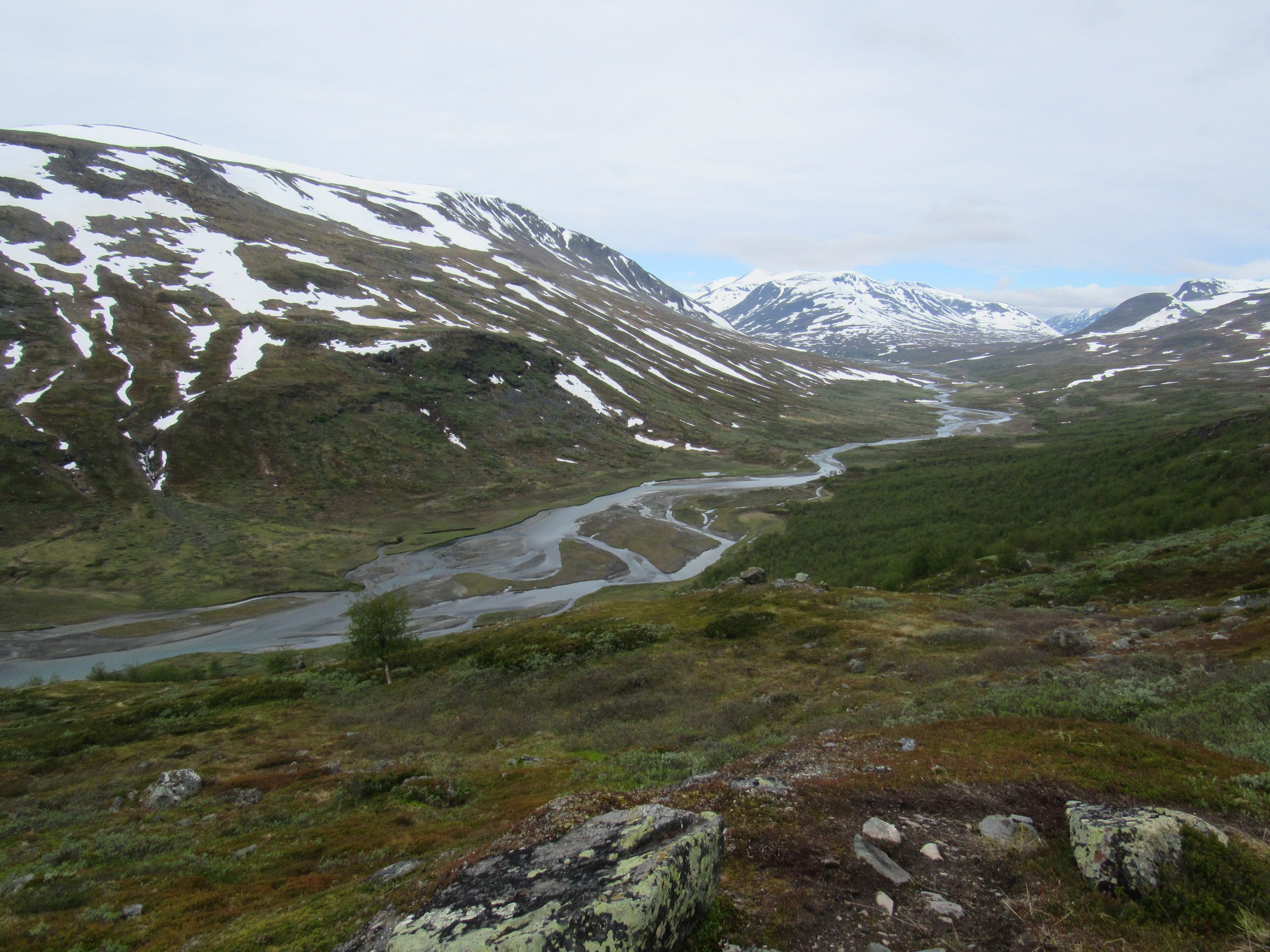
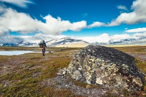
Straight ahead we can see the snowy steep cliffs of the 1922 meters high Niják. We will rise to a height of more than 900 meters. On a clear day we can enjoy a beautiful view of U- shaped valleys carved by glaciers. Beyond the highest point of this valley we will make
camp.
-
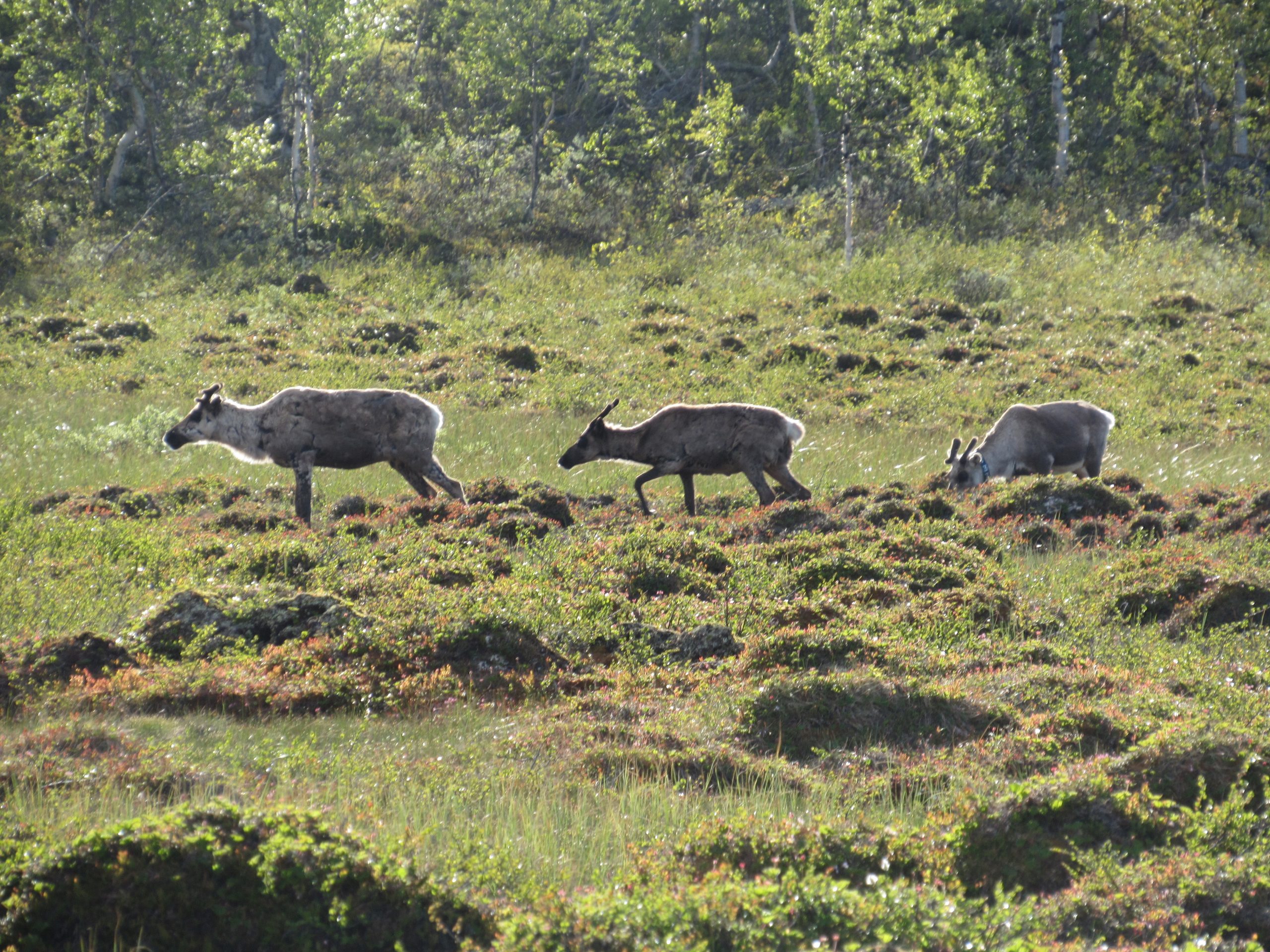
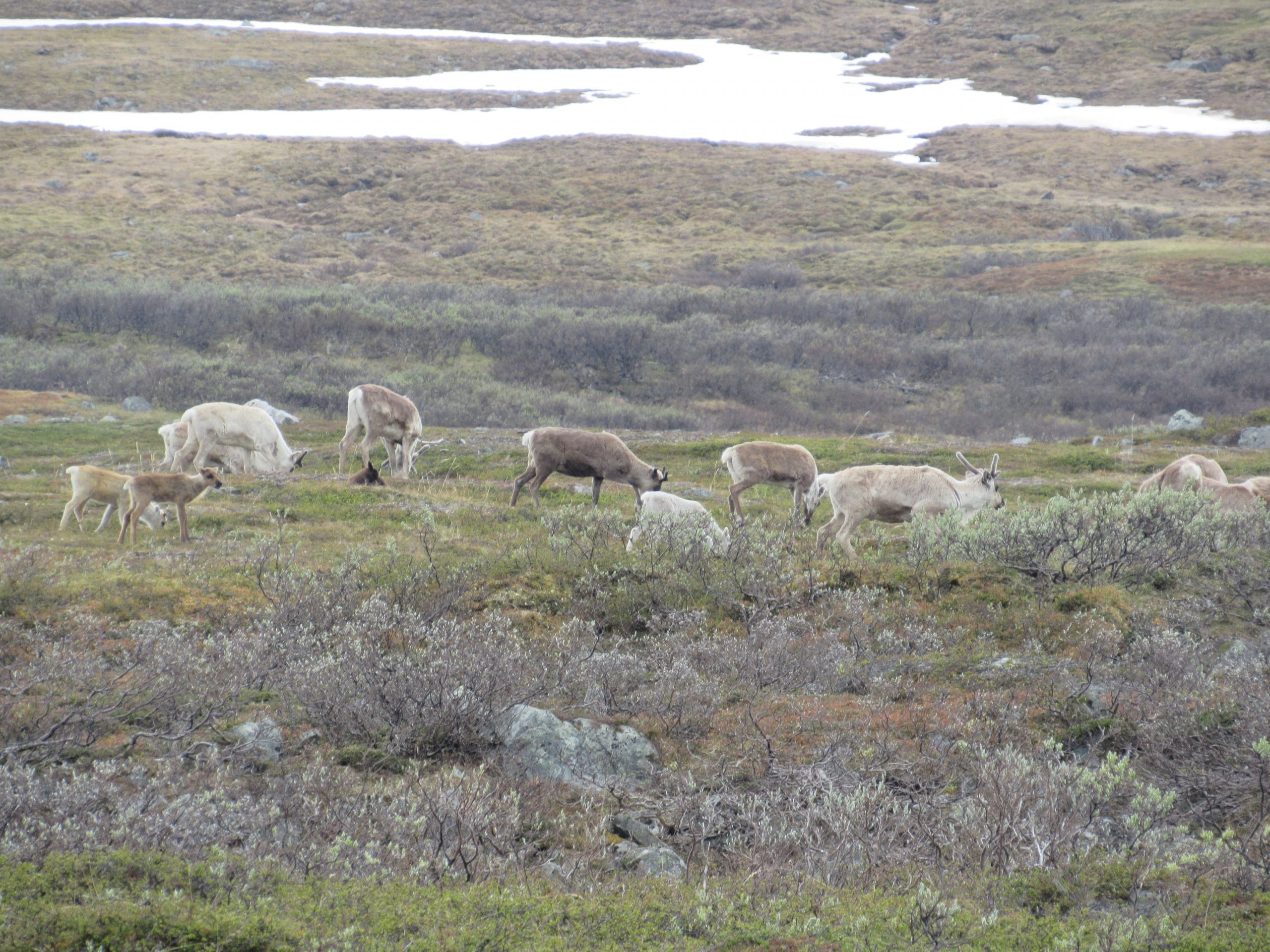
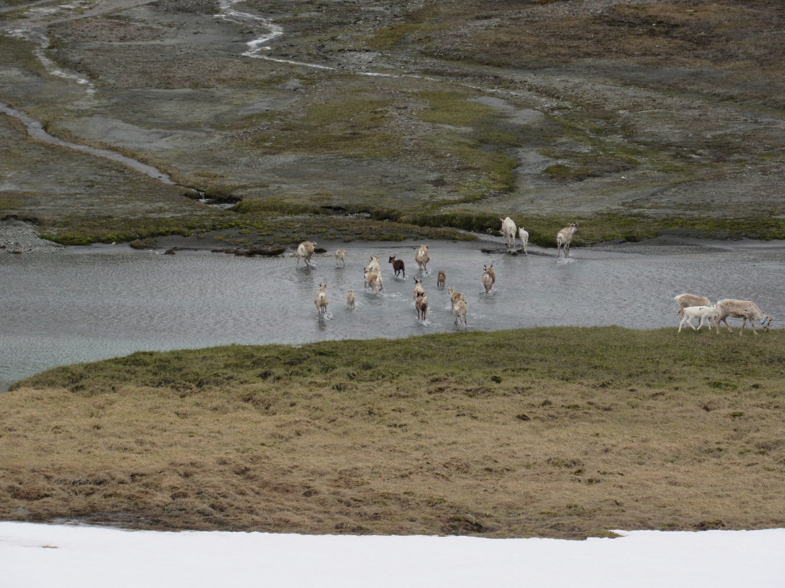
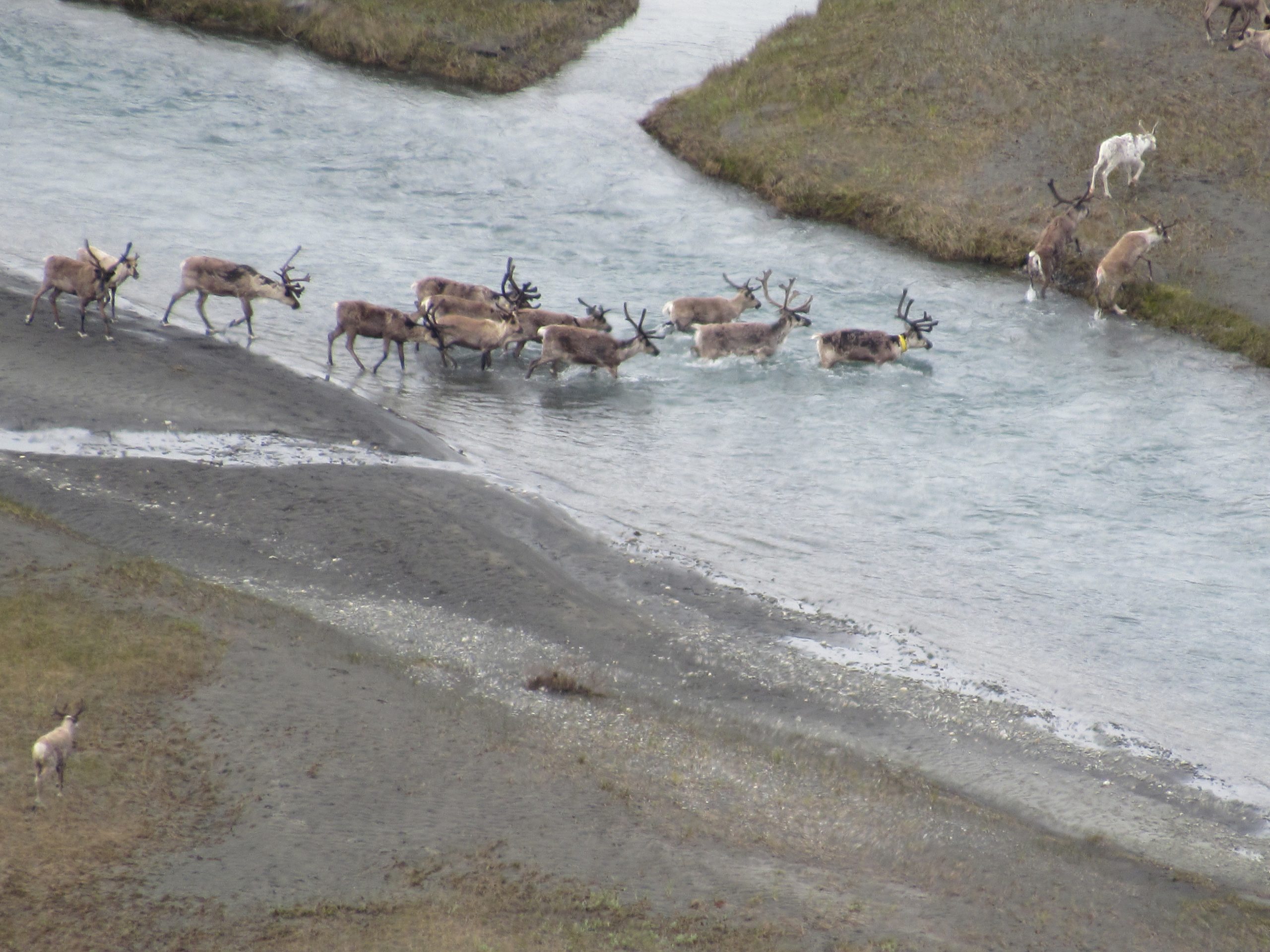
(17 km) Today is one of the most beautiful days of this trip. Both on the left and on the right hand rough, black vertical walls and/or white glaciers flank us. Impressed by this we pass the highest mountain of Sarek on the left hand (Sarekjåhkkå, 2089 m). Maybe we will spot herds of reindeer. We are at last in the land of the Sami.
The Sami are originally nomadic people who have lived here for many centuries. The Sami live traditionally as nomads who follow reindeer herds in their annual food migration. The reindeer deliver the milk, meat and skins together. They also serve as a draft animal.
After crossing the Tjågnårisjågåsj, known as the most exiting river crossing of Sarek.
We ‘ll pitch up our tents and stay the night.
-
(15,5 km) We will start early in the morning with a relatively steep ascent and we will rise to a height of 1025 meters, this is the highest point of our trekking. After a steep descent we are going to encounter the first bushes and following a current of a small stream, the beginning of Rapadalen. Further away it forms the largest river of Sarek. Our camp will be on a beautiful spot surrounded by steep walls shaped by ancient glaciers.
-
After waking up and breakfast we will break up our tents, surrounded by steep walls in the north and in the south. We will pack the equipment in our backpack and move further on in an artic landscape, rich in biodiversity, such as the moose, wolverine, lynx and fox. One of the largest populations of brown bears in Europe is living here in Rapadalen, but they are very shy and non-aggressive.
We will proceed along the valley and now the environment begins to change. Slowly we descend and the valley grows wider and the forest of small birch is getting bigger and larger. Today we will just like yesterday be treated on seeing beautiful rock walls and glaciers on either side of us.
Night in tent.
-
(15 km) We abandon Sarek N.P. and catch a boat transport to Aktse. We are now on he well-marked Kungsleden and will pass a cabin with a small shop. We enter into forest and go up and pass the treeline, where we can have splendid views across the surrounding lakes and mountains. After a steep climb of nearly 450 meters we will finally reach a gentle descend to a lake.
On shore we will make camp.
-
Spare day.
-
(19 km) The last day of hiking between the mountains and through the forest. We are going up and down and just before Saltoluokta we will encounter a steep descend before we have sight of the cabins. Once back in the civilisation we can enjoy the use of a shower, sauna, bar, Wi-Fi, and an excellent restaurant.
Night in STF-Fjallstation Saltoluokta.
-
In the morning we will leave Saltoluokta and cross the lake by ferry and go by bus to Gällivare to catch the nighttrain to Stockholm. We will sleep in the nighttrain and can buy simple refreshments on board (most of the time).
-
We will leave the train at Stockholm airport and catch the flight home.
End of program.